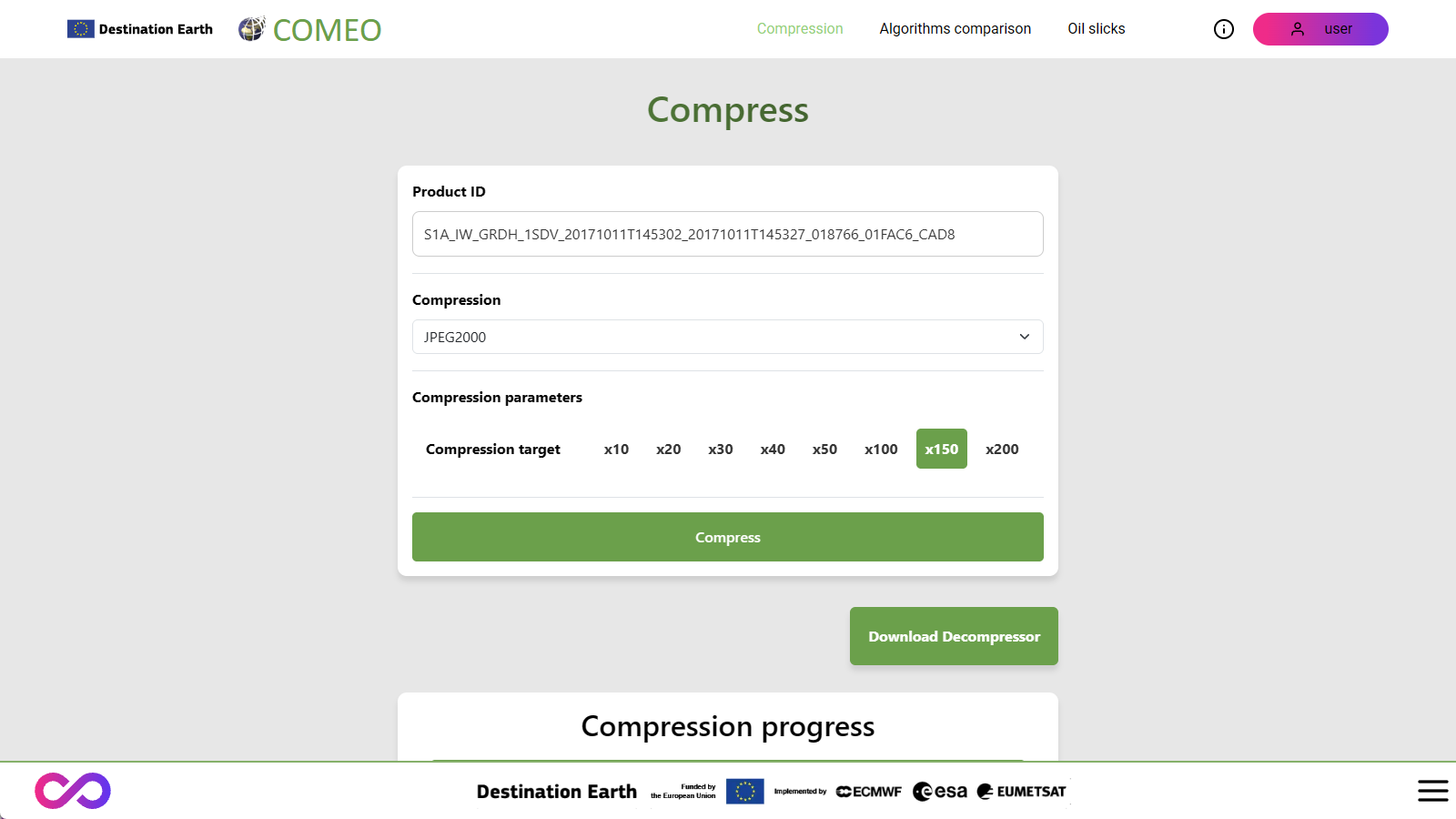
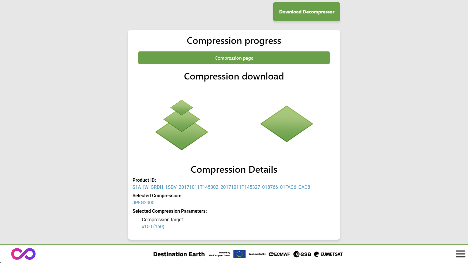
The COMEO service (Compression Of Models & Earth Observations) aims to compress Earth observation data (Sentinel-1 and Sentinel-2) and Earth modeling data (such as C3S ERA5) using lossy algorithms.
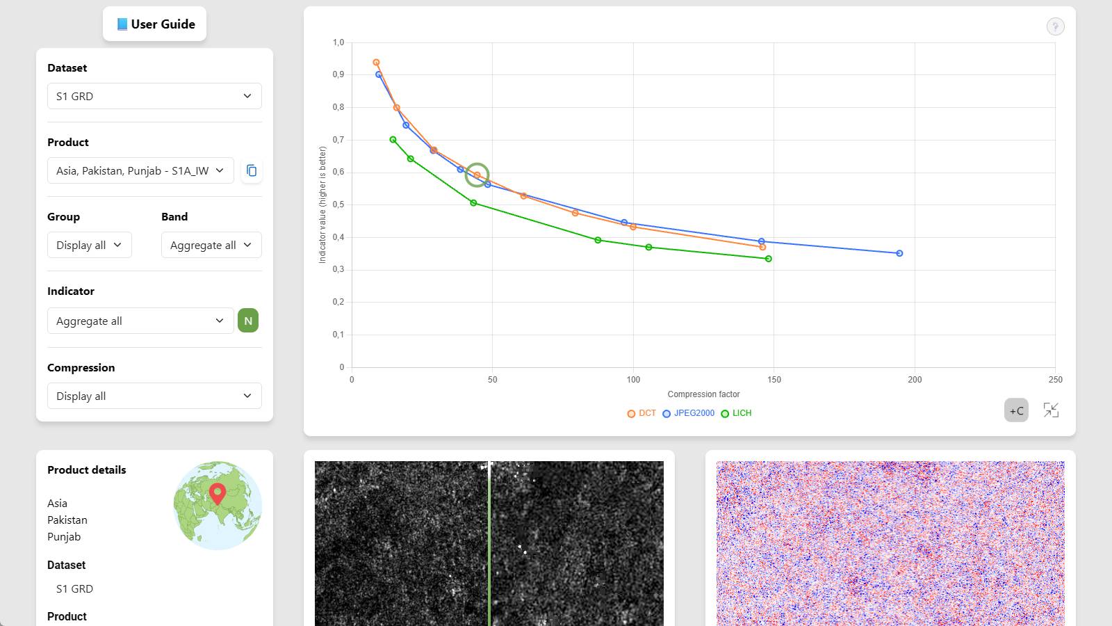
The following algorithms are available:
DCT (based on JPEG-XL)
DWT (based on JPEG 2000)
LICH (AI-based)
The compression factor ranges from ×10 to ×250.
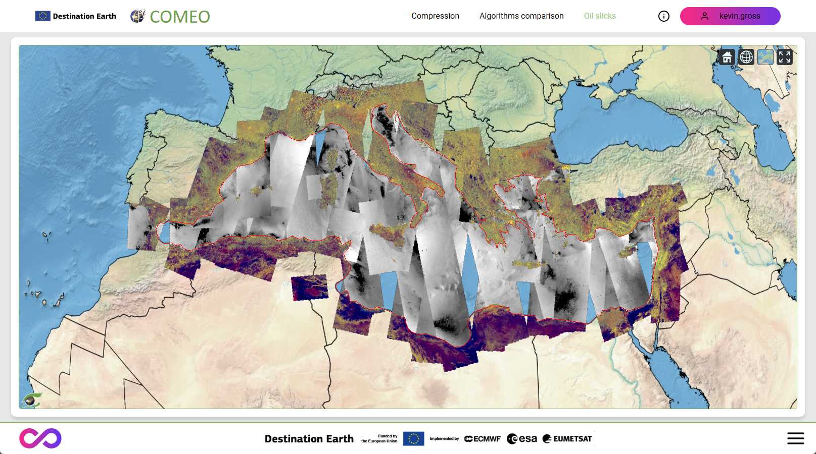
A demonstration tool is provided to illustrate the impact of lossy compression, along with a mapping tool that displays a synthesis of Sentinel-1 IW data over the Mediterranean Sea and across the full Sentinel-1 mission time range.